


PS Koregaon
Koregaon Taluka – Brief Profile
1) Area
-
94,840 hectares 1,275 sq. km
2) Population
-
Male: 107,343
-
Female: 107,834
3) Tourist Attractions (Brief Description)
-
Jarandeshwar Hill:
Located midway on the Satara–Koregaon road. A Hanuman temple is situated on the hill. -
Kedareshwar Temple:
A large Hemadpanthi-style Shiva temple located in Koregaon town. A fair is held here during the month of Shravan. -
Bhairavnath Temple:
An old Hemadpanthi temple in Koregaon town where a major religious fair is held. -
Kanherkhed:
The native village of the Scindia (Shinde) dynasty of Gwalior. -
Nandgiri Fort (Kalyangad):
A 12th-century fort located about 13 km from Koregaon. It was captured by the army of Chhatrapati Shivaji Maharaj.
4) Historical Sites and Background
Koregaon Taluka in Satara District has a rich historical heritage. Important sites include Kanher-Khed (birthplace associated with Mahadji Shinde), Rahimatpur (former taluka headquarters during British rule), Ambabai Temple at Kinhai (recognized by UNESCO), and the ancient Shiva temples at Solshi, which highlight the historical and social importance of the region.
Major Historical Places
-
Kanher-Khed:
The ancestral village of the Scindia family of Gwalior. It is believed that the great Maratha general Mahadji Shinde was born here. -
Rahimatpur:
Former taluka headquarters during the British period, where all government offices were once located. Later, the headquarters were shifted to Koregaon for administrative convenience. -
Kinhai (Ambabai Temple):
A UNESCO-recognized ancient temple of great religious and historical significance. -
Shanidev Temple, Solshi:
A famous and large Shanidev temple visited by thousands of devotees every Saturday. It is associated with the monastery of Gagangiri Maharaj. Entry of women is prohibited, and carrying leather items is not allowed due to traditional customs. The temple is also known as “Sixteen Shiva Lingas” and is located at the foothills of Harali Hill, making it an important spiritual site.
5) Primary Schools
-
182
6) Health Facilities
-
Primary Health Centres: 07
-
Sub-Centres: 36
-
Ayurvedic Dispensary: 01
7) Anganwadi Centres
-
Project–1: 198
-
Project–2: 190
-
Total Anganwadi Centres: 388
8) Circles / Groups
-
Circles: 12
-
Groups: 06
9) Veterinary Dispensaries
-
Total: 17
-
Category I: 05
-
Category II: 12
-
10) Municipal Bodies
-
Rahimatpur Municipal Council
-
Koregaon Nagar Panchayat
-
Number:
-
Municipal Council: 01
-
Nagar Panchayat: 01
-
11) Rivers, Dams and Forts
Rivers:
-
Tilganga
-
Vasna
-
Wangna
Dams:
-
Nandwal (Solshi) Dam
-
Talhira Dam (Deur)
Forts:
-
Kalyangad
-
Sakhargad
-
Chandan–Vandan Forts
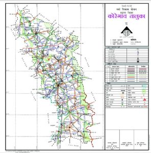
नकाशा/Maps- कोरेगाव/Koregaon
| गुगल नकाशा दुवा/Google Maps link |